
We provide award winning solutions

The world’s population is set to increase to 9bn by 2050.
Therefore, there is the need to provide food security by reducing crop wastage and improving farming productivity.

We utilise satellite data to gain insight & intelligence to support end users in the agriculture & transport sectors.
GGIS
Global Geo-Intelligence Solutions Ltd (GGIS) is a geospatial data analytics company. We provide geospatial intelligence and engineering solutions for resource and infrastructure monitoring and management.
GGIS turns geo-spatial data into intelligence to support decision making. We have a passion to use technology to empower individuals and communities to thrive in a constantly changing world. In today's world there is access to data from a myriad of sources. We need to go beyond just data and into insight and information that enables appropriate action making.
We integrate geospatial data from a wide variety of sources including earth observation satellites, GNSS, IoT sensors and crowd sourced data. Through analysis of this data and correlation with relevant events or history we provide information and intelligence to support decision making.
Lena River Delta - false colour composite.
Source: USGS EROS Center. Nasa Landsat Earth as Art Series. Image acquired by Landsat7 ETM+ sensor.
OUR SERVICES

FORESIGHT Services
Utilising satellite based data to provide predictive analytics and monitoring services such as:
Foresight Carbon - a satellite based Carbon sequestration monitoring platform.
Foresight DRM - a Disaster Risk Management Service.
Foresight Crops - predictive analytics and risk forecasting for insect infestation and soil productivity.
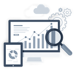
Data Analysis
Data cleaning, analysis and visualisation services enabling insight into trends, patterns and correlations in your geospatial data sets.

CONSULTANCY
Advice and support on geospatial matters. This includes issues such as change mapping, GNSS positioning, sensor integration, mobile app development and other mapping needs.

Insight
We utilise data from earth observation satellites, global navigation satellite systems and other data sources to provide decision support intelligence to end users.

Innovation
Our award winning platform Foresight Crops applies innovative technology and data analytics. We utilise the latest sensor technologies and artificial intelligence to provide bespoke solutions for our customers.

Collaboration
We work with our partners and clients to deliver sustainable solutions. We have partners and clients in the USA, Europe, the West Indies and across Africa

Foresight Carbon
Monitoring carbon uptake of forests from space
Demand for carbon credits to offset carbon dioxide emissions is on the rise and will continue to grow over the next decade. To keep global warming on the 1.5°C pathway, it is not enough to just reduce emissions. Instead, we need to start absorbing carbon dioxide from the atmosphere at large scale. Planting new trees and restoring old forests has an enormous potential to mitigate climate change, but it is still largely untapped. A lot of these projects do not have a positive business case due to high transaction costs.
Foresight Carbon is a fully automated service that measures carbon stocks in forests and tracks the benefits of forestry carbon sequestration projects over time. It is based on satellite data and state-of-the-art data analysis. Foresight Carbon offers project developers a ten-fold cost reduction, compared to their current field measurement methods. On top of that, the data-based approach boosts confidence with potential offset buyers and other stakeholders, resulting in carbon credits that are better marketable and more valuable.
Our technology and the service we offer is the cornerstone of a plan to enable tonnes and tonnes of additional net emission reductions together with our partners. If you are interested in finding out more about this service then contact us at hello@foresightcarbon.com
CONTACT US
Global Geo-Intelligence
Solutions Ltd,
The Ingenuity Centre,
University of Nottingham
Innovation Park,
NG7 2TU
enquiry@gg-is.com
FOLLOW US
@Global Geo-Intelligence Solutions Ltd
@GlobalGeoInt
PROFILE
Global Geo-Intelligence Solutions (GGIS) is a geospatial data analytics company. We provide geospatial intelligence and engineering solutions for resource and infrastructure monitoring and management.
© Copyright 2024. All Rights Reserved.